Appalachian Trail, Days 29-31
Days 29 through 31 on the Appalachian Trail brought some great weather for the epically beautiful Roan Highlands. I reached Mile 400, and there was a rotating group of familiar people camping with me at the end of the day.

Day 29:
Start: Ash Gap (377.2)
Stop: US-19E (395.6), The Appalachian Station at 19E
Miles: 19.5
Elevation Gain: 3479 feet
Total Miles Hiked: 424.04
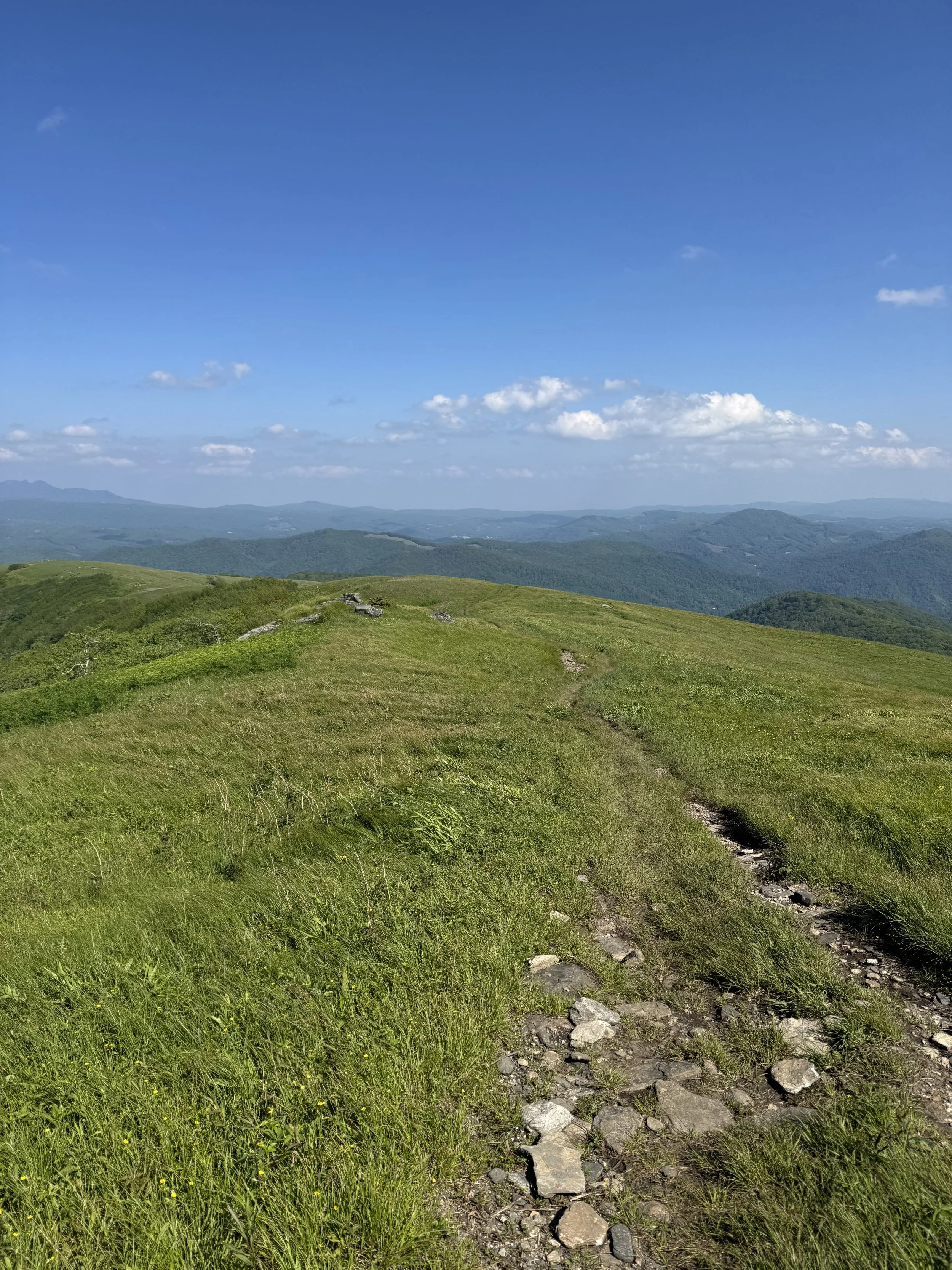
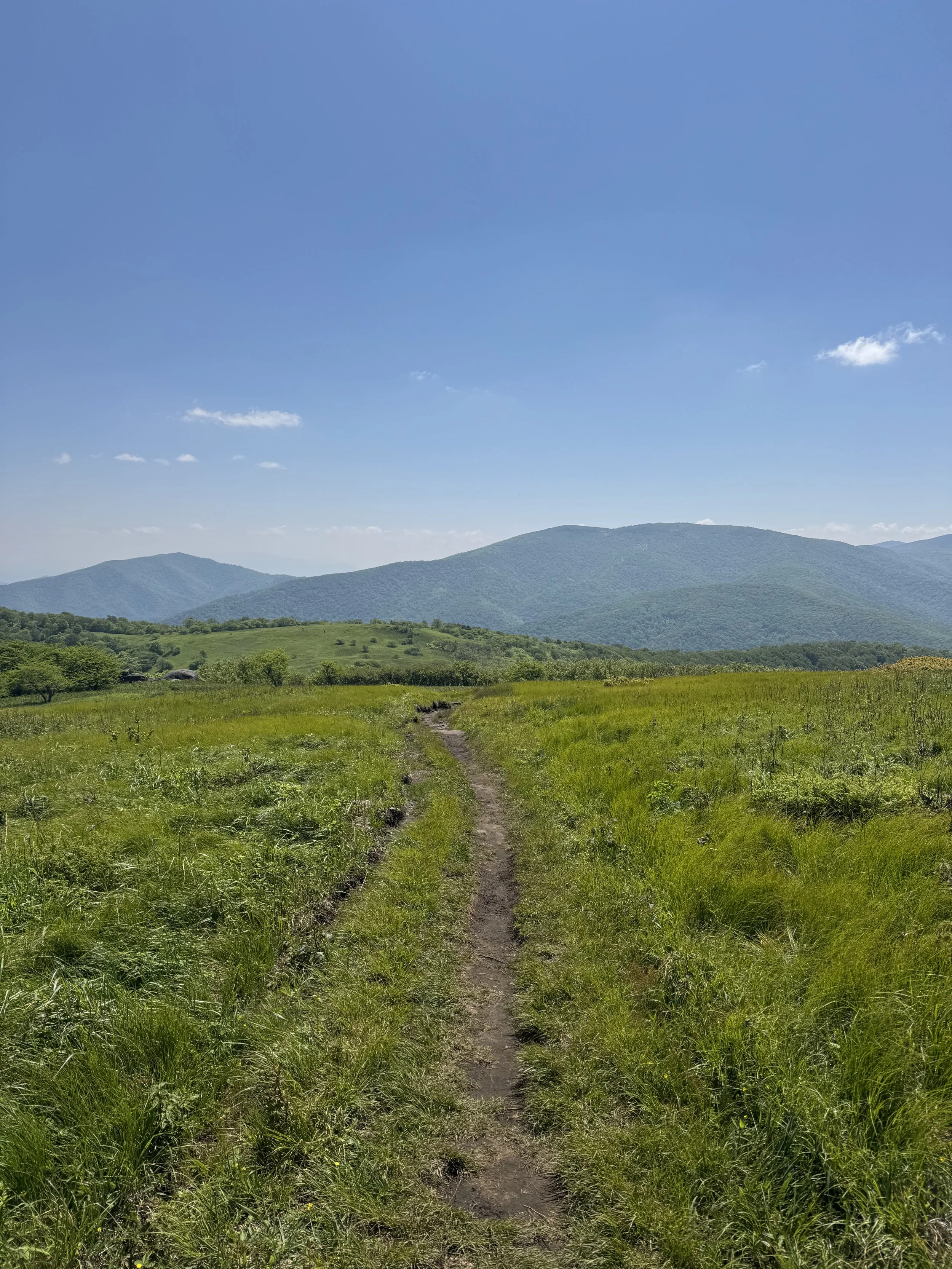
It was a beautiful thing to wake up to sun rays on my tent and blue skies. After several days with soaking downpours, it was a relief to pack away dry gear, and what an ideal stretch of trail to be gifted beautiful weather! I descended down to Carver’s Gap and realized it was the same place that my friends Adam and Annika took me for an AT day hike last year when I was teaching at Penland. It was just as wonderful as I remember and it was interesting to redo the miles within the context of a full thru-hike. This part of the trail is known as the Roan Highlands, with open balds that give you a perch to view the mountains far into the distance.
There was a nice inviting rock overlook on the way up so I decided to stop and have a snack. Fireball and Hedgehog caught up as I was sitting and Hedgehog came to join me. Moving on, the epic views continued for a bit longer until the trail dipped down into the trees and bushes. Soon I reached the shelter where Adam, Annika, and I turned around to head back to the trailhead last year, this time, there were already some familiar faces at the picnic table. I didn’t stay too long, just long enough to inhale a tuna packet, and then moved on. There were some grassy meadows flanked with green rolling hills and an intersection with the Overland Trail which was a significant location during the Revolutionary War.
Turning a corner, I was met with an expansive meadow and a giant bald rising up before me. It felt like walking through a Windows screensaver. The trail was visible in the distance, snaking along the landscape and marked with white-blazed posts through the grassy terrain. This was only a preamble to the view of Hump Mountain that greeted me when I emerged from another short walk through some trees. I could see hikers passing across Bradley Gap which led to the base of the climb, then inching up the treeless mountain. After admiring the view, I got started. I passed some weekend backpackers on the way up, and stopped to eat a snack on a rocky outcropping of a false summit. After another quick ascent, I reached the summit choked with people, as a large youth group was gathered there. It was a bit jarring after the solitary climb so I moved on quickly.
The climb down featured the windswept Doll Flats, with its tall grasses blowing in the wind. I started to move more quickly at this point. I was aiming to stay at The Appalachian Station at 19E after all the hype I’ve heard about their karaoke night. But their kitchen closes at 7:30 and I was afraid I wouldn’t make it. After some hustling and accidentally dunking one of my feet in a river I was attempting to cross, I reached the road and set off in the direction of the hostel. I made it in time to order food, and Gage and Burner were there! While I made it in time to eat town food, I wasn’t so lucky with the karaoke night. After my sandwich, I got some beers to go and moved upstairs to the hostel area. I chatted with the guys as they organized their resupply and did my laundry.


Day 30:
Start: US-19E (395.6), The Appalachian Station at 19E
Stop: Moreland Gap Shelter (414.0)
Miles: 18.7
Elevation Gain: 4384 feet
Total Miles Hiked: 442.71
I hung around the hostel drinking coffee as I waited for my clothes to dry. Gage abandoned his leftover pizza in the fridge, so I took advantage of the windfall. With pizza and coffee consumed, I got a ride back to the trailhead from the hostel owner. I climbed through a field with high grasses where I saw two stray dogs doing their thing, the trail also passed along a cemetery. There was a climb down a hillside with a few big blow downs from the hurricane that I had to navigate. I ran into Brian and we hiked together for a bit, picking our way through the fallen tree trunks and branches.
I passed by Elk River which looked inviting on this warm day with its water moving shallow and slow. I had a break on a bench overlooking Hump Mountain across the valley, and tried to strategize a shuttle pickup to get into Damascus for karaoke on Friday. The rest of the hike was somewhat unremarkable and I arrived at Moreland Gap Shelter at dusk. Hedgehog was the only one there, and we talked as I set up my gear. This shelter was damaged in the hurricane, but the trail club managed to repair it enough for campers using a tarp. The picnic table was also splintered and propped up using some tree stumps. As we were eating dinner, Forest and his dog Jack arrived, an overnight stop on their section hike to Damascus. Jack excitedly pulled at his leash, sniffing around camp and devouring his food. This would be my first time shelter camping with a dog, and I settled into my sleeping bag hopeful that his presence would help to keep the bears away.


Day 31:
Start: Moreland Gap Shelter (414)
Stop: Boots Off Hostel & Campground (428.1)
Miles: 15.8
Elevation Gain: 3037 feet
Total Miles Hiked: 458.47
I could hear some rodents moving around in the dark and I woke up to see Hedgehog packing up before sunrise. I ate some oatmeal and listened to Forest tell me about where he’s lived and worked, places like the McMurdo Base in Antarctica. As someone who is fascinated with the Werner Herzog documentary “Encounters at the End of the World” about the base, I was eager to hear more. I didn’t have a huge way to go today, I was shooting to camp at Boots Off Hostel about 13 miles away.
As I hiked, I quickly reached the parking lot for a recreation area that was clearly well traveled. I walked along a river for a little while and there were some interesting canyons and cliffs that I passed as I went. When I came to the blue blaze for Laurel Falls, I walked down the long stone staircase to the grand waterfall. There were a few scattered groups on the banks or swimming, and I took off my pack to sit on the rocks for a while. The falls reminded me of a waterfall I visited with Leslie and Emily when we were hiking the Grafton Loop Trail in Maine a few summers back. After a bit, I put on my pack to continue. There was a fun little section where the trail skirted around the narrow ledge of the cliffside flanking the trail. Then the AT continued on a mellow stretch following the river with some beautifully constructed bridges allowing me to cross back and forth.
There was one last bit climb and then I descended down to the turn off for Boots Off Hostel and Campground. It was one big compound with lots of outbuildings with lots of areas to lounge and everything a hiker could want or need. I piled into the gigantic striped vintage van from 1986 and we tore down the steep driveway into town to hit up some food and resupply spots. Back at Boots Off, I devoured my food, completely blissed out. I reconnected with Scooby and Bookie, and as it got darker, Fireball wandered in. There was an incredible outdoor shower and I sat on a lounger as Scooby played Chappell Roan mashups. Someone started a fire in the fire pit and a well trained dog carried logs over for the blaze. Notably, I saw 3 snakes today.

