Appalachian Trail, Days 1-5

Standing below the approach train arch at Amicalola Falls State Park.
I made it through the first few days! Now I’m holed up in a hostel outside Hiawassee, GA trying to decide what to do about the heavy rain and thunderstorms forecasted for the next few days.
Day 1
Start: Sandy Springs, GA, Amicalola Falls Visitor Center (-8.9)
Stop: Hawk Mountain Campground (7.4)
Miles: 16.7
Elevation Gain: 4146 feet
Total Miles Hiked: 16.7
We woke up in our Sandy Springs hotel and spent the morning repacking and organizing our groceries from last night. At 9:30, the shuttle driver arrived to take us up to Amicalola Falls. I decided to do the approach trail, because what do an extra 9 miles mean in comparison to the rest of a thru-hike? We only spent a few minutes at the visitor center and then headed outside to take some pictures beside the stone arch. With little fanfare on a beautiful sunny day, I started hiking the Appalachian Trail at 11:15 am on May 6, 2025. It’s true what they say about the Amicalola steps; they’re a rude awakening with a full pack. But after that, we transitioned onto regular trail for the ascent up Springer Mountain. We got to the official terminus in the mid-afternoon and spent a few minutes taking pictures and signing the logbook.
From Springer, we planned to hike a few more miles to the Hawk Mountain campground. By the time we got to camp, I was feeling pretty spent. Since we started late in the day, we only arrived with just enough time to set up camp before sunset. We were the only ones at the campsite, and it was a bit eerie, owls hooting in the distance and all the unfamiliar sounds of the outdoors. We even had a conversation with a bobcat prowling around in the woods nearby as we were falling asleep.
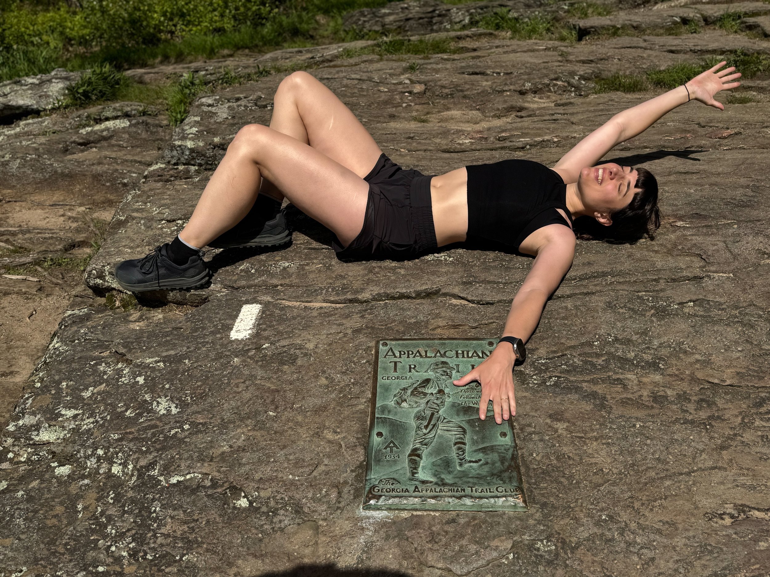
The Southern terminus of the Appalachian Trail and the first white blaze.

A selfie with Alex, my hiking companion for the first few days.
Day 2:
Start: Hawk Mountain Campground (7.4)
Stop: Hostel Above the Clouds, Woody Gap (20.5)
Miles: 14.5
Elevation Gain: 3202 feet
Total Miles Hiked: 31.24
We had our first taste of AT weather in the morning, with the rain on our tent as an alarm clock. We packed up swiftly and decided to hike to the nearby Hawk Mountain Shelter to have breakfast under cover. When we arrived there were a few campers still lingering, easing my fears about being all alone on the trail. We made conversation with the group, eating our breakfast, and waiting for the rain to ease. The morning hike was misty, and all our vistas were obscured by fog. We stopped at another shelter for lunch, and luckily, the rain was clearing. There, we met a few more travelers and made conversation.
For our sleeping plans, we decided to get a room in a nearby hostel, so I could have internet to finish my grading for the semester. The shuttle driver from Above the Clouds Hostel came to get us from the trailhead, and Bounce gave us a tour of the house when we arrived. It was super comfortable and had everything we could need for the night. We cooked frozen pizzas and met a few more nobo thru-hikers around the kitchen table, talking with Emma and Tortuga.

Alex in the Georgia forest.

A sign we passed on the way to the gas station near Above the Clouds Hostel.
Day 3:
Start: Hostel Above the Clouds, Woody Gap (20.5)
Stop: Bull Gap Campground (32.4)
Miles: 12.4
Elevation Gain: 3146 feet
Total Miles Hiked: 43.64
Today was the climb up and over Blood Mountain, the highest point of the Georgia AT. Luckily we had a clear day. This was another more arduous climb, but we were rewarded at the top. We climbed a huge boulder to see the sweeping views and explored the old stone shelter at the summit. On the climb down, we walked across a few more flat stone slabs overlooking the landscape and carefully navigated some rockier sections of the descent.
At the end of the climb down the mountain, we reached Neel Gap, and crossed the road to spend some time at Mountain Crossings. Unfortunately, there was no beer OR ice cream (as I had promised Alex). But there were frozen pizzas and soda, and we sat on the peaceful patio enjoying our break. Around 5ish, we packed up and hiked about a mile up the trail to camp for the night. As we set up camp, a few others joined us, picking some of the open sites nearby. It was a beautiful evening, and we all hung out as a group for a few hours, making dinner and making conversation. Once we were all settled in our tents, a thunderstorm rolled through around midnight.

View from the top of Blood Mountain.

Iconic Neel Gap sites.
Day 4:
Start: Bull Gap Campground (32.4)
Stop: Blue Mountain Shelter (50.3)
Miles: 18.38
Elevation Gain: 3921 feet
Total Miles Hiked: 62.02
Since the elevation profile for the day didn’t seem completely nuts, we decided to try and push our mileage. It was another nice day, and there were some peaceful vistas and easy miles. We contemplated maybe even doing our first 20 of the trail, but decided to call it a day at the last shelter before the descent down to the road. A few of our friends already had their tents set up when we arrived. We all made food at the shelter picnic table and Fuego got the fire going after dinner. It feels like all my gear is always slightly damp, so it was nice to be warmed by the dry heat of the fire as night fell. Once we were all settled down for the evening, a camper nearby decided it would be a great time to blast his music. It was very annoying, but at some point I was able to fall asleep despite the noise.


Day 5
Start: Blue Mountain Shelter (50.3)
Stop: Hiawassee, GA, Unicoi Gap (52.7)
Miles: 2.26
Elevation Gain: 256 feet
Total Miles Hiked: 64.28
In the morning, we hiked only 2.5 miles to the trailhead at Unicoi Gap. It would be Alex’s last night of the trip, so we decided to rent a hotel and have a town day. It was our first hitch of the trip, and we were able to get a ride into town with a friendly couple and their 3 dogs. They dropped us off at the supermarket and we spent an hour planning out our next move. We checked into our hotel and immediately tried to find some food, so we walked to a brunch spot around the corner. After a filling meal, we walked around town in the rain then lounged around in our hotel room. For dinner, we walked over to the brewery down the street and enjoyed some beer, food, and live music. Overall, a successful town day and a nice way to celebrate before Alex’s departure tomorrow!
